Locked Inside a Nave Since the Fourth Century CE – Part I
25 August, 2014
This week On the Reading Rest I have an article on the rune stone from Hogganvik, Mandal, in Southwest Norway. This stone was mentioned OtRR 9 January, 2012, but there is no point in looking it up since in the present entry the perspective from 2012 has simply been developed.
 Schultze, Michael. 2013. The Norwegian Hogganvik Stone as an Emblem of Social Status and Identity. Journal of the North Atlantic 4:120-128. Acronym: MiSCHu.
This article is extremely informative, 80 different references in 7 pages, but in the end, which is called Principal Conclusion, the stone and its inscription becomes a general and quite unspecific reflection of the commonplace when it comes to the Late Roman Iron Age (LRIA 150-350 CE): “… it reflects a hierarchical society.” (MiSCHu:125). Since ‘status’ and ‘individuality’ is not mentioned in this first sentence the rest of the conclusion links the sponsor to these concepts. The Principal Conclusions may thus be summarized as the first sentence in a BA exam essay on the LRIA in south Scandinavia: “In the Late Roman Iron Age South Scandinavia was a hierarchical society with marked symbols of power and social identity emphasizing status and individuality”. A peevish teacher will of course stick in ‘eventually’ before ‘individuality’, but otherwise not bother much because this introductory phrase has been the archaeological wisdom for the last 30-40 years.
How come that such an intricate inscription and deep knowledge lead us to no more that the commonplace?
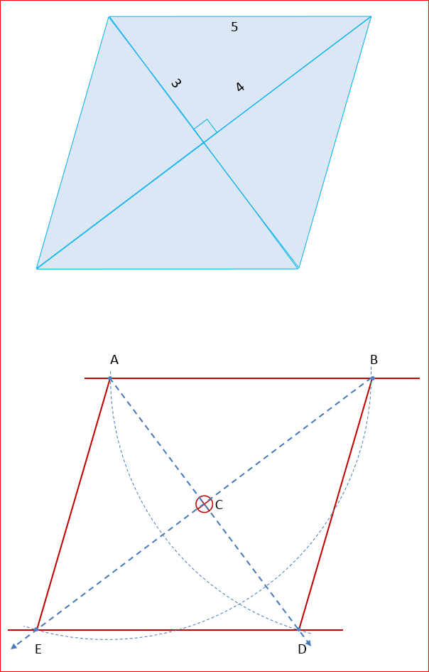
Some runologists have had trouble understanding that early rune stones do not always, just because it is possible, commemorate a deceased person. Already when Sven B F Jansson discussed the stone from Järsberg in Värmland, where excavations eventually showed that the stone was erected on a small natural hillock and not on or next to a grave, he noted this peculiar and century-old runological bias (1). Early rune stones are never typical formulaic headstones or memorials and they differ significantly from contemporary Roman headstones or the formulaic Scandinavian memorial rune stones, which date to the Carolingian Iron Age. The formulaic nucleus of the latter consists of three parts: The Sponsor – erected the monument after – The Deceased. One might have expected that in Scandinavia, Roman Iron Age man, given his possible connections with the Roman army, would have adopted some sort of Roman headstone formula. But that is not the case. There are one or two possible parallels in design, such as Möjbrostenen, but none in expressions. In fact there is no reason to believe that a text commemorates a deceased and names a sponsor if the text is not unambiguous.

Most often it takes archaeology to figure out the context of a rune stone. The Hogganvik inscription is a case in point. For a short while, before the archaeological excavation, this rune stone was a headstone standing on a grave. After the excavation it was not, but to runologists its alleged commemorative character featuring the deceased and the sponsor prevailed. In all fairness it must be said that MaSCHu is a significant step away from this preunderstanding, but it nevertheless continuous to colour his reading and interpretation of the inscription (2). Since there are non-lexical runes in the inscription, obscure concepts such as magic and/or cipher must also be allowed a priori to structure the text in a runological discourse. (cf. MiSCHu:123)
Demonstrating these difficulties understanding the topographical and monumental context of the stone, Hogganvik is a sad modern case in point. Based on Glørstad et al. 2011, commented upon OtRR 9 January, 2012 (3), is was easy to sum up the context: Today, we know so much that we can approach the stone as it would quite likely have been approached around 400 AD. It stood as a poster and if we were not locals we would probably have approached it from the South following a road going North through or along a small cemetery. We would have passed by the most prominent grave and then just before the road turned left and down in a slope or between two hills we would have stood in front of the stone.
 The stone, moreover, stood in a monument of its own and to a great extent the layout of the inscription and thus the shape of the stone was reflected in the contours of this monument laid out in kerbstones. The position of the rune stone itself within the monument corresponds to the two short lines. The stone was chosen and cut; the kerbstones laid out, and the stone put in its place.
To sum up: the longest part of the inscription frames the two shorter parts. The longest is a proportional map of the outline of the interior of the monument in which the stone was erected. The two shorter parts are situated more or less where the stone stood. Thus the layout of the inscription is a map of the monument. The material context is manifest and not without material agency.
Since the design of the stone consciously parallels that of the monument, the layout of the text is a complement to the layout of the monument. Because this fact is not ‘textual’ in the pre-1980 still frequent runological usage of the concept ‘textual’, some runologists feel free to overlook it. Probably, they lose interest when archaeologists produce contexts, which runologists would not already have recognized in the text. Thus the idea of the headstone is not given up as long as it can be slightly moderated. Consequently, the deceased and the sponsor are still live & kicking — that is agency-wise.
It is commonly agreed, but no longer by MiSCHu, that the longest part, the broken line in which the sections are read towards each other, made up one series of runes and an expression which contained a series of 14 non-lexical runes situated mainly in the second part of the line. The broken line is read it in this way:

and the result becomes: kelbaþewas⁞stainaz⁞aaasrpkfaarpaa⁞inananaboz (line Z)
In this part of the inscription the text is divided into smaller sections by means of vertical dots (⁞), which separate the non-lexical runes from the lexical, and stainaz from kelbaþewas. It would have been easy to organize the inscription in three lines, read boustrophedon – as the oxen ploughs: from right to left to right to left – if clarity had been an issue:

Since this solution was not chosen, simple clarity probably did not guide the carver (4).
On the one hand there is no doubt that the correspondence between the inscription and the shape of the monument dictates the layout of line Z. Ekerafaz and eknaudigastiz on the other hand are meant to make up two lines within the ‘monument’ as it is outlined on the stone. Therefore, we shall have to figure out whether ekerafaz (line X) and eknaudigastiz (line Y) are meant to be read first or last. Since these lines similar to the stone itself, are situated in the centre of the monument, they are probably the most important ones and indeed two parallel lines. This indicates that the simplest way to read the text is to start in the centre with the meaningful line, ek erafaz—I Erafaz, and proceed upwards reading lines X – Y – Z, in order eventually to have read through ‘the whole monument’. This means that we start by reading the inside of the monument, i.e. the rune stone, and proceed to cover its perimeter, the kerbstones.

Since inscriptions that mix lexical and non-lexical runes, usually adhere to a systematic pattern: lexical – non-lexical – lexical, in such a way that the last lexical section brings the inscription to an end in a few words, the X – Y – Z reading becomes even more reasonable. ‘Innananaboz’, to be sure is typical lexical cadenza and there is no need to start all over again with a new expression such as ‘ekerafaz’. ‘Ek’, i.e. ‘I’, mreover, is a common somewhat pompous introductory pronoun (Table 1).

On the Hogganvik stone word wrapping doesn’t necessarily indicate a major break in the text and there need not be a break between eknaudigastiz and kelbaþewas. Dots on the other hand always do. This means that there is probably a break between kelbaþewas and stainaz. Since there are no signs to end an expression, the dots simply mark out a beginning that the carver thinks is not obvious. Evidently, this is the function of the dots between kelbaþewas and stainaz. Stainaz is the beginning of something and kelbaþewas thus the end. These dots are necessary because kelbaþewas stainaz—Kelbaþewa’s stone is otherwise a perfectly reasonable expression.

Since most runologists expect the texts to be inscribed on a headstone, they disregard the vertical dots and read what they expect: ‘Kelbaþewa’s stone’. In fact they will think that disregarding the dots is a consequence of the two words.
Be this as it may: if the text, guided by lines and dots, can be read as two propositions – one, preferably the last, containing a non-lexical expression close to the end of the whole text – it should be read so, for instance:

The first line, Ek erafaz ek naudigastiz kelbaþewas, is a nominal sentence: I Erafaz, I Naudigatiz (am) Kelbaþewa’s
Since erafaz means ‘wolverine’ and Naudigastiz ‘need-guest’ and kelbaþewa ‘chilver-servant’ (chilver is ‘ewe lamb’) and since they are words used as appellatives and/or proper names, the sentence runs: I Wolverine, I Needgest (am) Chilver-Servant’s. Wolverine presents himself with a name, in effect an appellative, as Chilver-Servant’s need-guest. ‘Guest’-names and ‘servant’-names as well as ‘need’-names are Late Early Iron Age names (5).
The second line, ⁞stainaz⁞aaasrpkfaarpaa⁞innananaboz, is a sentence too. ‘Stainaz’ is the subject and ‘innananaboz’ is a prepositional phrase or a postpositional adjective referring to stainaz. ‘Innana’ is a preposition which governs the genitive. It means inside or within, and ‘nabu’ means nave, but not just in a wheel.

For some reason, Michael Schulte seems not to contemplate that innananaboz might be a postpositional adjective describing stainaz. In Scandinavian languages this way of constructing an adjective is common, not least in Danish, which MiSchu doesn’t mention: inden+bords, inden+bys, inden+dørs, inden+lands, inden+rigs, inden+skærs or inden+sogns. They are always matched by their antonym “uden+…”. There are also local usages applicable when the difference between inside or outside is sufficiently significant. At Langör by Stavnsfjord on Samsø children in the 1950s could sail their dinkies “indenfjords”, but not “udenfjords”—in the fjord but not outside it.

Today there is no particular point in specifying whether the presence of something is either, or predominantly either, inside or outside a nave and there is no such word as “inden+navs”, but “indennavs” for “within the nave” is nevertheless unproblematic if one’s relation to naves is sufficiently dichotomous. Syntactically speaking, the non-lexical runes ‘aaasrpkfaarpaa’, which may be a representation of the act of an incantation, perchance a gealdor, or ‘alphabetic magic’ to runologists, stands in for a verb such as to sing or chant or express. The second sentence therefore describes the stone in the monument stating that: the stone ‘chants this (non-lexical) phrase’ inside the nave. It might of course have been Erafaz—Wolverine who taught the stones to sing: ‘aaasrpkfaarpaa’. In the two similarly structured inscriptions in the above table, DR 261 and DR 196, the ‘I’ rather than the object is the agent.
*
NOTES
(1) Jansson, Sven B. F. 1978. Värmlands runinskrifter. Sveriges runinskrifter. Vol. 14:2. Stockholm Almqvist & Wiksell International. Jansson discusses this on pp. 32-36.
(2) In this respect Knirk, James. 2011. Hogganvik-innskriften: en hard runologisk nøtt. Viking 2011. Pp 25-39 and MaSCHu:123 represent two different attitudes to preunderstanding.
(3) This is: Glørstad et al. 2011. Zanette Tsigaridas Glørstad, Jakob Johansson & Frans-Arne Stylegar. Minnelund og monument. Runesteinen på Hogganvik, Mandal, Vest-Agder. Viking 2011. Pp 9-24.
(4) It is not unusual that early inscriptions have a relation to the object on which they are inscribed, thus adding dimensions to their textual meaning, given that they are often written on artefacts.
(5) See below and Peterson, Lena. 2004 Lexikon över urnordiska personnamn http://www.sprakochfolkminnen.se/download/18.5e02b54a144bbda8e9b1c11/1398151044347/urnordiska-personnamn.pdf
Structuring King Harold’s 10th c. Jelling
11 August, 2014
 This week On the Reading Rest I have an article about the large 10th c. royal monument in Jelling, Denmark and its enclosure. Speaking of its dimensions and the fact that the palisade surrounds a number of religious monuments there is something almost Pharaonic about it. But instead of dressed stones Harold used wattle and daub, wooden structures, earthen mounds and natural boulders to construct his monument.
Dengsø Jessen et al. 2014. Mads Dengsø Jessen, Mads Kähler Holst, Charlotta Lindblom,Niels Bonde and Anne Pedersen. A Palisade Fit for a King: Ideal Architecture in King Harold Bluetooth’s Jelling. Norwegian Archaeological Review, 2014 Vol. 47, No. 1, 42–64.
Acnonymized: DJal.
DJal sum up the excavations at Jelling and put the site into a larger chronological, archaeological and political perspective. The short-lived but gigantic enclosure, covering c. 12.5 ha, was built in the 960s and early 70s. It may be that (1) building the enclosure and the houses within it, as well as (2) the opening of King Gorm’s mound and grave, (3) his reburial in the new church tagged by (4) the erection of the large rune stone advertising Harold’s good work and finally, perhaps (5) the relocation(?) to Jelling of the c. 20 year old stone commissioned in memory of Gorm’s queen Thyra, Harold’s mother, who died before Gorm – all this took place in the decade around 965 CE. The enclosed Jelling monuments were short-lived, but grand enough to match Harold – ‘the continental-style ruler’ (DJal:59). Jelling’s Pfalz-character or function as a royal assembly place is not a farfetched interpretation and its stress on formalism and geometrical planning catches the eye. Moreover, the fact that the Jelling monument is older than Harold’s rigidly planned circular ring forts, suggests that Jelling was the start of something great – significant and sufficiently provocative to be short-lived and destroyed in an arson attack.
 Bandholm (2013) (1) has shown that the lozenge-shaped palisade in Jelling is a rhombus with sides c. 360 m long comprising four large identical Pythagorean triangles with sides equaling 3, 4 and 5 units. Five units equal 360m and the four right angels are situated in the center of the rhombus. For what it is worth, there are geometrical coincidences with the great pyramid at Giza or vice versa – at least in principle. With a ruler, a setsquare and a pair of compasses this quadrilateral can easily be constructed on the drawing board. In principle, therefore, it can also be illustrated on a computer screen.
DJal shows that in the Jelling topography, materializing the theoretical ideal was not straightforward and they point out that the observed measures do not always fit the theoretical model – but then again why should they when close enough in Jelling is most impressive.

Further excavations may give us more clarity in these matters and DJal, representing the Jelling Project, are cautious in their discussions, as indeed they should be. On the Reading Rest is less committed and free to wonder how the architect(s) and/or surveyors went about plotting out the enclosure – not least its corners. Since ideologically inspired formalism in the construction of past-and-present as lavish monuments, is still with us, one may argue that Jelling was once a significant manifestation. Consequently, ruining the monument by setting fire to it reflected its importance and appalling, in effect, significant character. Since it is not self-evident how the monument was constructed, its construction itself might be outlandish.
In Jelling, the main problem when it comes to setting out the rhombus is contextual, caused by the monuments that occupied the site before the construction of the palisade. There are four musts to the initial construction work:
1) The center of the large mound predating the enclosure, must also be the centre of the rhombus. Since the centre is situated on top of a mound above the surroundings it is difficult to measure directly from it.
2) This centre must be aligned to an axis that is also the axis of the ship setting, which predates the mound. It is not given that the endpoints of the ship setting are aligned to the actual centre of the mound. Centre and endpoints must in other words be aligned in a best fit.
3) The distance between the centre and the endpoints of the axis must be defined as a fixed number of feet. In some way or other the precise distance from the center to a given point on the axis must be measured, preferably with some sort of triangulation.
4) North and south of the mound this axis must be level. This is because the distance to the points where the axis intercepts the palisade of the enclosure, that is, the northern and southern sides of the rhombus, must be measured directly on the ground, that is, by some sort of trilateration.
The mound is situated more or less at the centre of a ship setting as if the monument was a ship grave with a central chamber more or less where the mast would have stood. In this way, the monument is similar to ship graves such as Oseberg or Gokstad. The chamber represents the mast and somewhere above the chamber, the centre of the Central axis should be situated. The ship may have been ‘sailing’ towards the NNE or the SSW diverging c. 22.5° from North towards the East. Together the ship setting and the mound make up King Gorm’s grave monument. Gorm and his Queen Thyra, Harold’s parents, were to be commemorated in the enclosure, while at the same time Harold made a point of displaying his power, his Christian inclination and indeed his master builder capacity. The latter was a crucial part of his royal image and to less lavish-minded citizens, as well as the odd modern researcher, it borders on obsession (cf. OtRR 15 October, 2012). Since Harold wanted to reshape Jelling, there was a point in letting Gorm’s mound in the ship setting become the centre – the original root of the monument – after Harold had excavated it and moved his father to Harold’s new the Church where once a hall stood (2). Acculturating Pagan and Christian traits it was probably respectful to let the enclosure of old and new monuments proceed from the axis and centre of the first monuments. The cultural trait that would eventually combine the old and the new ideology was a hetero-normative elementary family – the married couple and their successful son. Talking to his architects, we can imagine that Harold would have listed the following operative paragraphs having said
King Harold:
A) Protects the old monument and incorporate it in the new as central historical objects, that is, heritage and origin.
B) Encloses them in the new monument thus exemplifying how the past corresponds to the present.
C) Builds a cenotaph, a mound commemorating his parents, his mother south of his father’s mound.
D) Builds a church between the mounds where the hall stood and moves the remains of his parents into a grave in the church.
E) Moves the old rune stone commemorating his mother to Jelling.
F) Erects a rune stone commemorating himself next to the church and his mother’s rune stone.
And the architect team came back with the idea of the lozenge-shaped enclosure. The head architect pointed to Bandholm’s theoretical construction, or a similar formulation of it, and its beauty, as a satisfying model. The King gave his consent, but pointed out once again that they were not to tamper with Gorm’s mound. The architect, reassuring and convincing as always, answered that there was no need to do so, because he had another triangle up his sleeve if needs be. The mound would not be damaged.
OFF THE TEAM went to establish the axis of the ship setting as the historical roots of the monument constructing the new monument on the basis of the axis of the old one – a theoretically simple, but practically difficult task. They started by establishing the axis as a line-of-sight between two points on the flat top of the mound. They define this line with two gormas and then they aligned arbitrary points to the North and the South and marked out the Central point, Cp.
 Having created the centre of the mound as well as the axis, they defined the fixed the points N’ and N as well as their distance to the Central point (Cp) by means of measurement (trilateration) and triangulation. Then they decide upon the length of the central axis making it longer than the ship setting.
Since this length was crucial to the construction of the outline of the palisade they sought a specific length long enough to enclose the ship setting and definable as a specific number of modules befitting their geometrical model. In some way or other they must have studied geometry and in all probability they had a book where they could look up different geometrical solutions to architectural problems. Rough measurement in the field and their model would tell them that if the sides of their rhombus were c. 1152 feet, then the palisade would be large enough to enclose the ship setting. Having done their calculations in advance they let the endpoints of the central axis be 1237 feet apart. This meant that the distance N’ – N must became 309 ¼ ft. They constructed S’ and S in the same way as they constructed N’ and N. In points N and S the Central axis intercepted the palisade line.
 In our measuring system 309 ¼ ft is slightly less than 100 m and that is a distance possible to measure directly. Nevertheless, creating the Central axis and the Cp is probably difficult and it is a great advantage if the ground is level around the mound – not least since points N’ and S’ must be level. To solve these problems they would probably have used some sort of chorobates or large scales or a device with water or whatever (2).
With their 5 points on the central axis they bring in a new triangle (sides 1 – 2 – sqrt 5) and define the Northwest corner (NW) of the enclosure along a line that is perpendicular to the central line in N’.

Having defined the NW corner they can make two lines of sight – the northern side of the rhombus, NW → NE, and its NW → SE diagonal.

The Northwest point, NW, is situated 618½ feet from N’, that is twice the distance between N and N’. Theoretically the hypotenuse of this triangle is sqrt(12 + 22), that is, the square root of 5. The present case is a practical application of this quasi-Pythagorean triangle:
sqrt (309.252 + 618.502) = sqrt 691,5040 … or ≈ 691,5 ft
The difference between 619,5040 and 691,5 ft is c. 0.1 cm. The architect must have had some practical knowledge about the proportions of the 1 – 2 – sqrt 5 triangle and understood that in some situations it could be useful.
Creating the sixth point, NW, implies in the following: The 619½ ft between NW and N equals 3 in a Pythagorean triangle with sides: 3 – 4 – 5 and its right angle in the Centre on the mound (Cp). Both NW and N are situated on the northern line of the enclosure. A line-of-sight from NW over N will reach the point NE 461 ft behind N (619,5/3 * 2 = 461) because NW-NE equals 5 in the Pythagorean tringle. This is a long distance, difficult to measure directly. The architect, therefore, anchored the 1 – 2 – sqrt 5 triangle in the points N’ and N (see above) and that enabled them directly to measure a point, NE’, situated close to N’, but also between Cp and NE. This means that a sight line from NW over N and from Cp over NE’ will meet in NE – the northeastern corner of the enclosure. In this way the architect has created the Pythagorean 3 – 4 – 5 triangle with the points NW-Cp -NE. This is the triangle which Bandholm (2012) refers to.
In this construction, the distances that must be measured directly are relatively short, c. 97 and 48 m respectively. They combine four level points: NW’, N’, N and NE’.
 To complete the rhombus the corresponding level points and triangles SE, S’, S and SW’ must be constructed and that turns out to be virtually impossible if the South mound had already been built. The mound is in the way for those who want to measure the distance between S’ and S
As long as the corners SW and SE have not been excavated it is difficult to know what’s right or wrong when it comes to these points – and even after an excavation it may be impossible to know. Archaeologically speaking, nevertheless, it seems that the South mound had not yet been built when the palisade was laid out (DJal:62:Fig. 11). The archaeological context makes the present model possible, but there are many ways of construction the rhombus. In the 10th c. the best models ought to have been inspired by Ockham’s razor inasmuch as they should involve little direct measurement between few level points and sight lines over points that are relatively far apart.
 Moreover, it should have been possible to check points in the way points Cp and NW could have been checked from N when NE’ had been defined.
There is another consequence of the model that might be interesting. The hall building, which ante-dated Gorm and Thyra’s(?) grave church, could be seen as parallel to the northern or southern side of the palisade. The alignment is not perfect, but possible. If so, then the house was probably built after the lozenge was laid out, and after the North mound was built.
 This would mean that some time, say 965 CE, the enclosure was planned and the hall south of the North mound erected and the palisade about to be built. The whole monument was thus a non-Christian environment – a classical scene: the hall next to the mound, in the ship setting enclosed by a palisade. Then – and that must have been quite suddenly comes Harold’s conversion to Christianity and the need to make the monument a Christian one with parents seemingly moved from their mounds to the new grave church built upon the hall – another classical scene!
Or the hall, a more or less East-West orientated building stood there before the enclosure was contemplated and Harold wanted its axis to be reflected in the new monument. In that case this turned out to be only not quite possible because the surveyors could not measure arbitrary angels.
Or the present geometrical model is wrong!
WHEN THE SOUTH mound was built is must have stood out as an echo of the past – a monuments from the 950s when Queen Thyra died and thus older than Harold’s monumental enclosure. If the mound was accepted as old it would have made the layout and construction of the enclosure enigmatic and perhaps wonderful, because it would have seemed that Harold’s surveyors in the late 960s could see through mounds.
It stands to reason that any charismatic ruler opposed to his father and his father’s quest for systematic and enigmatic formalism as well as show-off dressed up as Christianity, such as Svein Forkbeard, would burn down the palisade.
How many of the above boxes were ticked by the architect(s?)? four – perhaps all six:
√ A) They protected the old monument and incorporate it in the new as central historical objects, that is, heritage and origin (Perhaps they started to do this already when the hall under the church was built).
√ B) They enclosed them in the new monument as an example of how the past corresponds to the present.
? √ C) They built a cenotaph, a mound commemorating Harold’s parents, his mother south of his father’s mound.
√ D) They built a church between the mounds where the hall stood and move the remains of my parents into a grave in the (grave-)church.
?√ E) They moved the old rune stone commemorating Harold’s mother to Jelling.
√ F) They erected the rune stone commemorating Harold next to the church and his mother’s rune stone.
DJal’s article and the lozenge tag a new Jelling research and the role of Harold Bluetooth, the successful son, in the transformation of South Scandinavia. His antagonists may have burn down Jelling and made it a monument securely anchored in the past, but in so doing the future they embarked on nevertheless had to fit the place he staked out as his Denmark rather than the indefinite ‘Denmark’ mentioned e.g. by Alfred the Great. Harold’s ring forts lack a historical dimension in their construction, being thoroughly modern. Jelling, on the other hand, is a shrewd example of the present as rooted in and incorporating the past as well as of royalty rooted in farmsteads and manors (cf. DJal:59) (3). A contemporary of Ottonian Renaissance Harold’s monarchy boasted rural origins and systemic modernity partly resting on eternal geometrical principles.
NOTES
(1)Bandholm, N., 2012. The Arcane Eshøj Ell: applications from royal Egypt to royal Jelling. Acta Archaeologica, vol. 83: 275–86.
(2) The scale in the illustration is inspired by and article by Tom M Apostol:
Apostol, Tom M. 2004. The Tunnel of Samos. Engenering and Science 2004:1 pp. 30-40
(3) For a detailed argumentation see Holst et al. 2013. Mads Kähler Holst, Mads Dengsø Jessen, Sten Wulff Andersen, and Anne Pedersen, A., 2013. The Late Viking-Age Royal Constructions at Jelling, Central Jutland, Denmark: recent investigations and a suggestion for an interpretative revision. Praehistorische Zeitschrift, vol. 87:2: 474–504.
